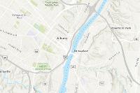
This (v2) vector tile layer provides a detailed basemap for the world featuring a classic Esri topographic map style designed for use with a relief map. A brief summary of the item is not available. Add a brief summary about the item.
Tile layer
from
Item created: Oct 26, 2017 Item updated: Feb 20, 2025 View count: 239,265
Description
This vector tile layer provides a detailed basemap for the world symbolized with a classic Esri topographic map style. This vector tile layer is similar in content and style to the World Topographic Map, which is delivered as raster fused map cache tile layer. This vector tile layer provides unique capabilities for customization and high-resolution display.
This layer includes highways, major roads, minor roads, railways, water features, cities, parks, landmarks, building footprints, and administrative boundaries, designed for use with shaded relief for added context. The map is built using the same data sources used for the World Topographic Map raster basemap and other Esri basemaps.
Use this Map
This map is designed to be used as a basemap layer or reference layer in a web map. You can add this layer to a web map and save as your own map. If you would like to use this map as a basemap layer in a web map, you may use the vector basemap Topographic web map.
Customize this Map
Because this map is delivered as a vector tile layer, users can customize the map to change its content and symbology, including fonts. Users are able to turn on and off layers, change symbols for layers, switch to alternate local language (in some areas), and refine the treatment of disputed boundaries. See the Vector Basemap group for other vector tile layers. For details on how to customize this map, please refer to these articles on the ArcGIS Online Blog and view the Esri Vector Basemaps Reference Document.
An in-depth description of the item is not available.
Tables
Basemap
Project Contents:
Solution Contents
Contents
Layers
Screenshots
Terms of Use
 This work is licensed under the Esri Master License Agreement.
No special restrictions or limitations on using the item's content have been provided.
Details
Dashboard views: Desktop
Source: Vector Tile Service
Creating data in:
Published as:
Other Views:
Dependent items in the recycle bin
Applicable: 2d
Size: 977.7 KB
ID: 7dc6cea0b1764a1f9af2e679f642f0f5
Image Count: 0
Image Properties
Layer Drawing
Using tiles from a cache
Dynamically from data
Share
Owner
Folder
Categories
This item has not been categorized.
Tags
basemap, Esri Basemaps, Topographic, esriTopographic, wma, vector
Credits (Attribution)
No acknowledgements.Sources: Esri, TomTom, Garmin, FAO, NOAA, USGS, © OpenStreetMap contributors, and the GIS User Community

Comments (21)
This is the replacement for the other World Topographic Map (non-vector) Tile Layer that is in mature support. Will this replacement product ever include the contour lines like the other product has?
You can utilize this Web Map (or access the tile layer used in it). Topographic (with Contours and Hillshade). It is a multisource vector basemap that is designed for Map Viewer (not map viewer classic). It is available through the Living Atlas: https://www.arcgis.com/home/item.html?id=7378ae8b471940cb9f9d114b67cd09b8
Why is the World Topographic Map and other similar maps not updating to the latest version of the web like Google Maps?
Is there an available basemap like this that is able to be downloaded in its entirety as a tile layer and used on a closed network?
https://www.arcgis.com/home/item.html?id=df541726b3df4c0caf99255bb1be4c86
Hello, we are trying to understand the source of the elevations and contours on this map, and what vertical datum was used in it? As per our understanding the layer refers to the World Hillshade layer which seems connected to the Terrain (elevation) layer, however, we do not see any information regarding the VCS used. Is the VCS used WGS 1984 or EGM 08 as the projection system is WGS 1984 Web Mercator (auxiliary sphere) .
A detailed esri topo base map for mapping